Ecogeomorphic Feedbacks & River Morphodynamics
Interactions among flow, sediment, and riparian vegetation
Riparian vegetation and morphodynamics are strongly coupled in many rivers, which we are studying in a range of settings. On the Bill Williams River (BWR), AZ, we have documented the geomorphic and vegetation responses to dam construction, and to a series of dam-controlled flood releases. These floods, although small compared to historic floods on the BWR, were designed with input from scientists in order to investigate the hydrograph characteristics needed to promote the establishment of native riparian vegetation (primarily cottonwood and willow), to cause mortality of non-native tamarisk seedlings, and to affect geomorphic changes associated with vegetation responses. The BWR is serving as a unique natural laboratory for investigating ecosystem responses to flow regimes and thereby improving the quantitative basis of environmental flows. Environmental flow releases on the BWR are motivated by the presence of a high-quality native riparian ecosystem and associated bird communities and are part of a broader partnership between The Nature Conservancy and the Army Corps of Engineers, the Sustainable Rivers Project. [PDF 1] [PDF 2]
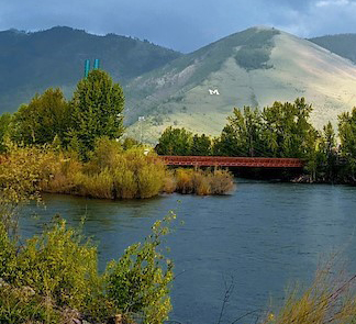
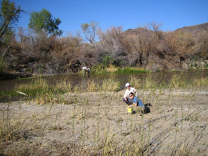
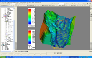
High-resolution surveys (with airborne and ground-based lidar) are being used to quantify relationships between vegetation and topography. We are also measuring the forces required to uproot cottonwood and tamarisk seedlings and evaluating controls on seedling uprooting. Field sites for this work include the BWR, the Santa Maria River, AZ, and the Bitterroot River, MT.
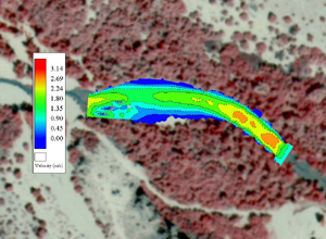
We are also using computational and laboratory modeling to assess relationships between hydrograph characteristics, channel morphology, hydraulics, and vegetation response. Flume modeling has been completed at the Saint Anthony Falls Laboratory's Outdoor StreamLab and at the UC-Berkeley's Richmond Field Station. These efforts are in collaboration with Anne Lightbody (UNH), John Stella (SUNY-ESF), Patrick Shafroth (USGS Fort Collins Science Center), Leonard Sklar (SFSU), Rich McDonald, and Jonathan Nelson (both USGS Geomorphology and Sediment Transport Laboratory).
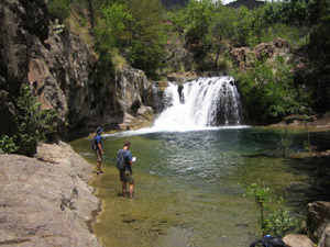
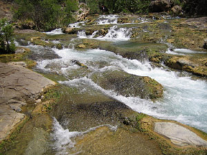
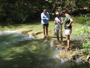
Fossil Creek, AZ
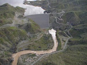
In collaboration with Leonard Sklar (SFSU), his students, and researchers at Northern Arizona University, I have contributed to the investigation of ecogeomorphic feedback in the evolution of travertine step-pool morphology in Fossil Creek, AZ following dam decommissioning. Fossil Creek is a remarkable stream in which calcium carbonate precipitates out of carbonate-rich water to form travertine dams. Following a decommissioning agreement with Arizona Public Service, full flows were returned to Fossil Creek in 2005 and the Fossil Creek Diversion Dam was removed in 2008. We have taken advantage of the restoration of Fossil Creek and the rapid regrowth of travertine step-pool units to study geomorphic-ecosystem interactions and effective discharges. [PDF]